
Winter Storm Warning: 5 Things To Know About Weekend Snow Attack
Brace yourselves, Washingtonians, for a late winter storm that has begun across the region and will continue through the weekend. Ironically, it is Western Washington and not as much Eastern Washington. which will bear the largest snowfall and therefore interruption to normal life.
Could this become the new normal? Is climate change to blame for this shift? The debate will continue, but, in the meantime, what we do know is that there will be some fairly harsh winter weather for us to contend with, and here are 5 things to be aware of.
1) There is a Winter Storm Watch through Saturday Afternoon in Seattle & Vicinity. The National Weather Service Office has issued this statement:
...WINTER STORM WATCH REMAINS IN EFFECT FROM FRIDAY AFTERNOON
THROUGH SATURDAY AFTERNOON...
* WHAT...Heavy snow possible. Total snow accumulations of 3 to 8
inches possible. Highest amounts on the Kitsap peninsula.
* WHERE...Portions of northwest and west-central Washington.
* WHEN...From Friday afternoon through Saturday afternoon.
* IMPACTS...Travel could be very difficult.
PRECAUTIONARY/PREPAREDNESS ACTIONS...
Monitor the latest forecasts for updates on this situation.
Seattle could see 8 inches or more of snow by the end of the weekend. That will make for some very problematic driving conditions. This will be short-lived thankfully, as temperatures will rise and get back to the usual rain and mid-'40s for high temps by Monday.
2) There is a Winter Storm Warning in effect for Mountain Passes Through Saturday Afternoon. The National Weather Service Office has issued this statement:
...WINTER STORM WARNING NOW IN EFFECT UNTIL 4 PM PST SATURDAY...
* WHAT...Heavy snow expected. Total snow accumulations of 6 to 12
inches expected along the east slopes of the Cascades through
Friday, with up to 18 inches above 5000 feet. An additional 8 to
15 inches can be expected Friday night through Saturday in the
Washington Cascades and 10 to 20 inches in the Oregon Cascades.
* WHERE...In Washington, East Slopes of the Washington Cascades.
In Oregon, East Slopes of the Oregon Cascades.
* WHEN...Until 4 PM PST Saturday.
* IMPACTS...Travel could be very difficult to impossible. Travel along the passes and portions of I-90 will be impacted. Very
cold wind chills of near to below zero are also expected.
* ADDITIONAL DETAILS...Breezy winds may cause blowing and
drifting of snow, which could cause areas of poor visibility.
PRECAUTIONARY/PREPAREDNESS ACTIONS...
If you must travel, keep an extra flashlight, food, and water in
your vehicle in case of an emergency.
3) Yakima Can Expect Cold Temperatures and 3 to 4 Inches of Snow through the weekend.
The estimates continue to be very fluid on the part of forecasters, as of this writing the amount of snowfall expected has diminished to 2 to4 inches total over the weekend. With the steady light snowfall all day today (Thursday) one wouldn't be surprised to find that total could be higher.
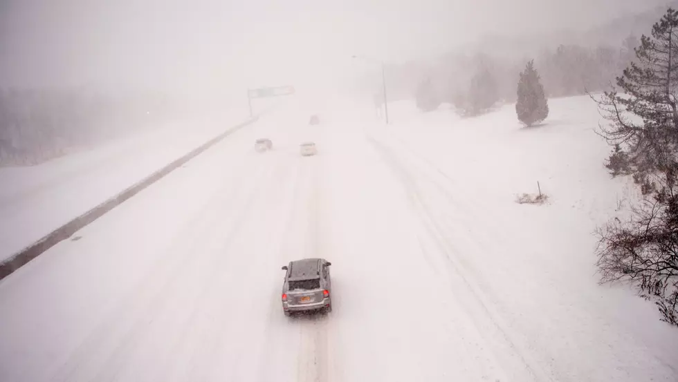
4) Driving Conditions Will Be Challenging At Times
It's really important for drivers to limit time on the road unless necessary, and when motorists do get behind the wheel, extra caution should be taken. Slow down and adjust your speeds and movements to the conditions. Leave plenty of space between you and the person in front of you to provide ample room and time for stopping.
5) Check-In on Your Neighbors Who Are 'Seasoned Citizens'.
It only takes a moment, so if you know of someone in your neighborhood or community who may be older and/or less able to get out and shovel snow, get to the grocery store, etc., check with them. They'll appreciate it and so will their family members who may live elsewhere and be unable to help. Also, take someone a batch of soup or dinner and it will warm them up in many ways.

TIPS: Here's how you can prepare for power outages
More From 94.5 KATS


